Blue gold
In the underground passages at Preuilly, you can admire the remains of the abbey's hydraulic network, which was set up in the early days of the monastery to channel the waters of the Ru de Montigny, among other nearby sources.
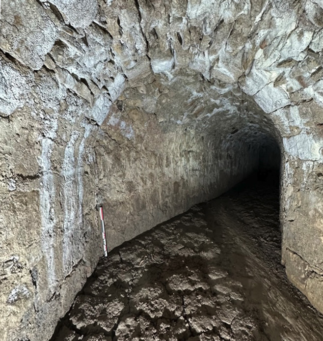
© Photo Anne-Marie Flambard
In the underground passages of Preuilly, one can admire the remains of the abbey’s hydraulic network, which was established in the earliest days of the monastery to channel the waters of the stream de Montigny. Domestic use, agriculture, gardens, fishponds, mills… the water needs were considerable—not only for the monks, who were rapidly advancing the development of the countryside, but also for the inhabitants of Montigny, who resented their privileges and near-exclusive monopoly over this “blue gold.”
Their anger was expressed through numerous acts of defiance: diverting the watercourse, destroying pipes, vandalizing fountains, stealing horses, beating monks, and even throwing stones at the abbot himself.
Such offenses led, in 1248, to a severe punishment: the offenders were required to present themselves at the chapter of the abbey, barefoot, dressed only in a shirt and breeches, and make amends to the abbot and the bursar for their excesses and insults, swearing never to repeat such actions (AD 77, H 328).
Despite these punishments, conflicts however negotiations continued until an agreement was reached in 1736 between the Abbot of Preuilly, Antoine Jérôme Boyvin de Vaurouy, and Daniel-Charles Trudaine.
A nobleman of Montigny, Intendant des Finances under Louis XV, and a brilliant scientist, Trudaine transformed the Château de Montigny into a highly refined estate, where he hosted his Parisian acquaintances. He redesigned the park with basins and canals, for which he secured the exclusive right to use the waters from Saturday noon to Sunday after Compline.
The château no longer exists today, but this is what it looked like around 1750:
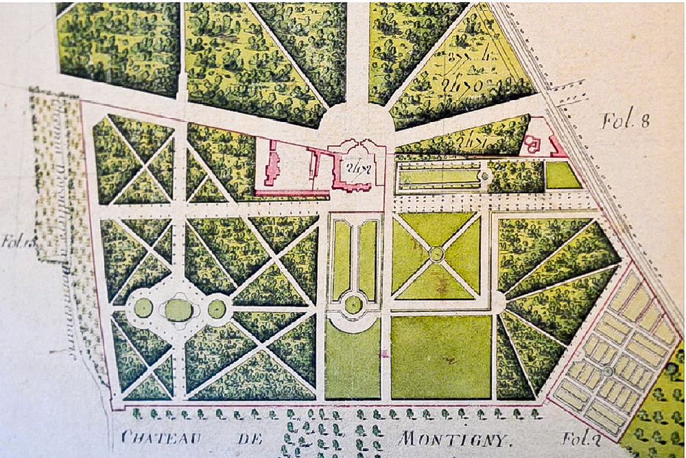
As you can see in the image, the château itself (in red) occupied only a small portion of a vast estate designed for research and experiments on improving agriculture—a subject that greatly fascinated Daniel-Charles Trudaine (born in 1703, died in 1769).
As head of the Ponts et Chaussées (Bridges and Roads Administration), he founded the École Royale des Ponts et Chaussées in 1747 and initiated a vast project known today as the Trudaine Atlas—a meticulous survey of all the roads in the kingdom and their surroundings. This collection comprises over 3,000 hand-drawn and watercolor maps, now preserved in the French National Archives.