21st-Century Techniques
François Blary - Anne-Marie Flambard Héricher
Images / All rights reserved
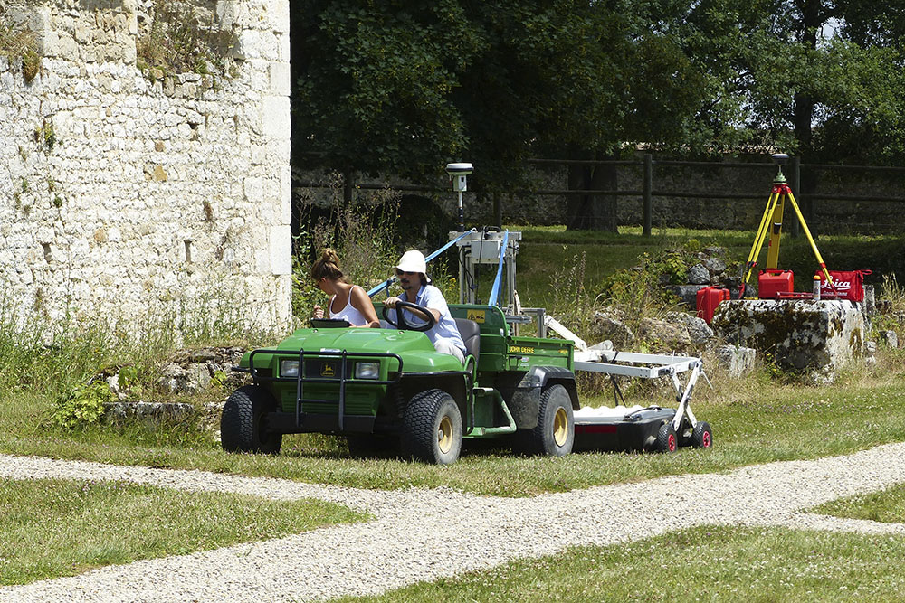
GEOPHYSICAL SURVEYS
A. Tabbagh (Pierre and Marie Curie University, Paris), M. Dabas (ENS, CNRS), G. Catanzariti (3D Geoimaging)
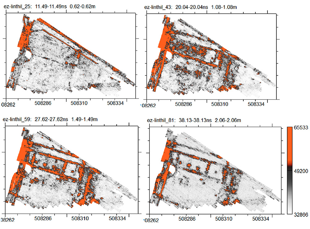
Ground-penetrating radar (GPR) is based on the emission of an electromagnetic wave into the ground to detect changes in material composition. The emitted electromagnetic wave either propagates deeper or reflects back to the surface, depending on changes in the soil’s electrical properties. By carrying out numerous adjacent and closely spaced measurement profiles, it is possible to produce maps showing these changes by depth. These variations may be natural (e.g., changes in rock or sediment type) or man-made (e.g., presence of walls, cavities, or backfill).
The depth of investigation using this method depends on the soil type and the nominal frequency of the antennas used. Frequencies typically used in archaeological contexts range from 200 MHz to 600 MHz, corresponding in practice to a maximum depth of 2 to 3 meters. GPR surveys are often combined with results from electrical resistivity surveys. The image below reveals the location of the lost south wing of the cloister (in orange).
BUILT HERITAGE ANALYSIS – STONE
F. Blary (Université libre de Bruxelles) and J.-P. Gély (LAMOP)
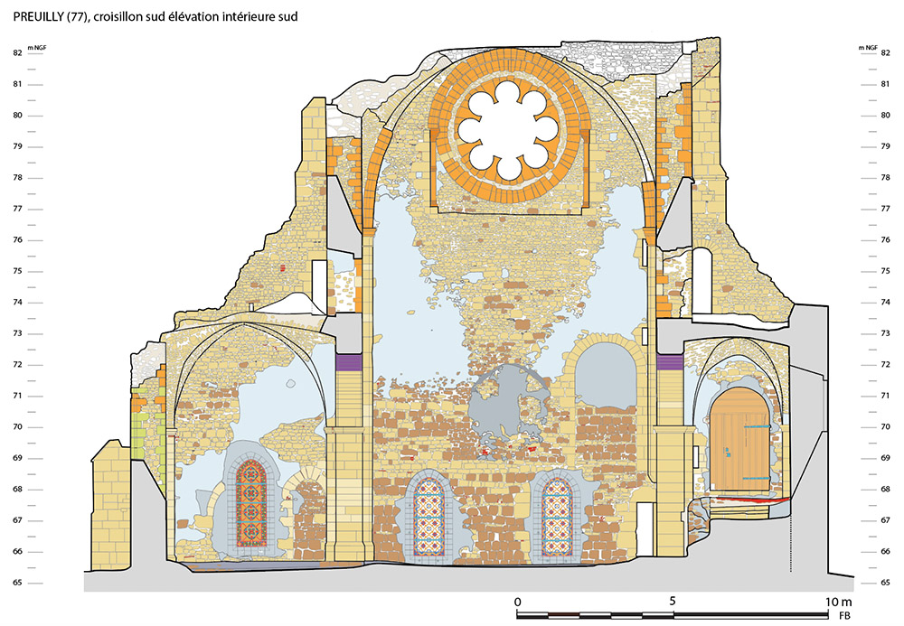
The monks initially tried to extract building materials from their own estate, which is why the abbey’s buildings feature walls built with rubble stone from local geological formations. The distribution of these stones within the masonry reflects material management practices on the construction site. However, when suitable dimension stone was in short supply, a change in supply source is often observed over the centuries. This was the case for the transept and choir of the abbey church at Preuilly, where Lutetian limestone originating from the outskirts of medieval Paris had to be imported. This supply underscores the importance and volume of river trade between Preuilly and Paris in the Middle Ages.
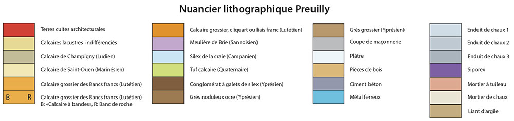
The identification of lithic materials was carried out for all the abbey buildings and recorded in a detailed stone-by-stone survey.
BUILT HERITAGE ANALYSIS – WOOD
Y. Le Digoll (Dendrotech)
Dendrochronology is an absolute dating method for wood that involves counting and analyzing the variations in the thickness of annual growth rings, which reflect climatic conditions. As a result, roof frameworks and floors are valuable sources of information for archaeologists.
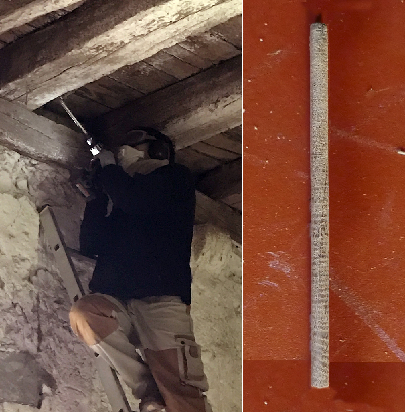
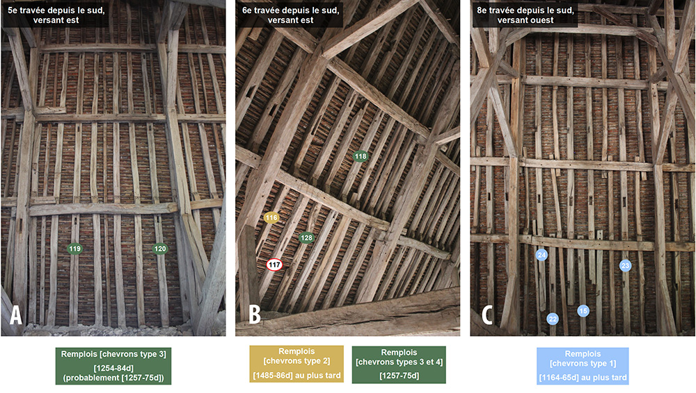
Numerous samples taken from the Grange des Beauvais revealed a southern roof structure dating to the 13th century, and an overall harmonization of the structure around 1507–1508 in the central section.
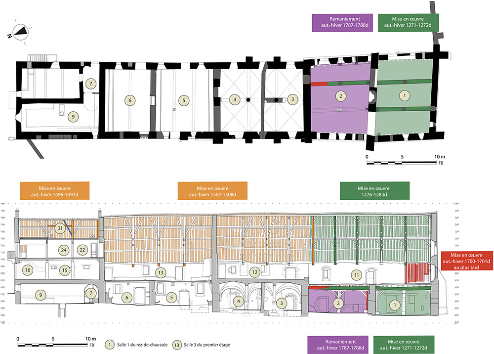
However, this 16th-century framework also re-uses older rafters from now-lost roof structures dating back to the 12th, 13th, or even 15th century.
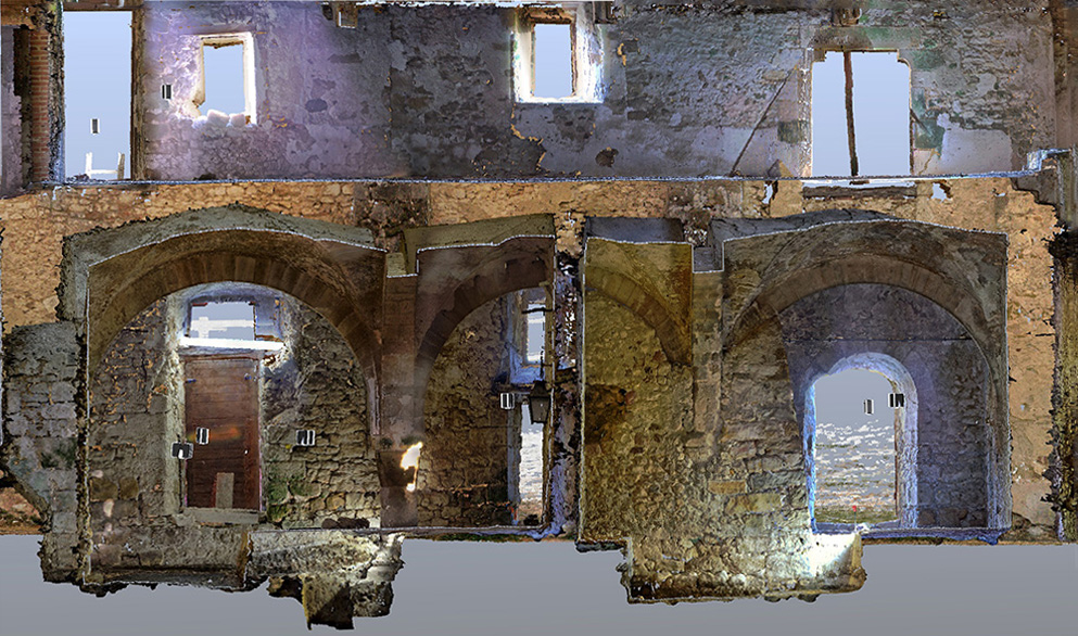
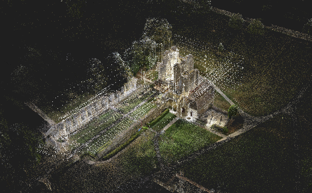
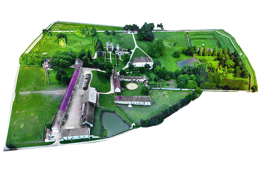
3D MAPPING
(Panorama platform, Université libre de Bruxelles)
Whether static or portable, 3D scanners enable the creation of digital twins of the studied structures. They have been used to virtually reconstruct the abbey, study the Grange des Beauvais, and explore the drainage system.
Point cloud model of the abbey church:
3D view of the abbey estate:
The grange des Beauvais